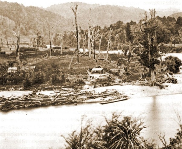
James Bragge, Upper Hutt Libraries Heritage Collections.
About this series
Upper Hutt’s story is inseparable from the history of its forests, rivers, wildlife and the people who have shaped them. Over the past two centuries, Te Awa Kairangi has undergone one of the most dramatic environmental transformations in New Zealand, from a densely forested valley rich in birdlife to the urban landscape we know today.
This series explores that transformation through the people, places and events that have shaped conservation in Upper Hutt. From the great forests encountered by the first explorers, through the era of clearance and loss, to the emergence of conservation, ecological restoration and the challenges of the future, each article examines a different chapter in the story of the valley’s natural heritage.
This first article begins with what has been lost – and what remains.
Part 1 – Te Awa Kairangi and Te Whanganui-a-Tara: What Was Lost, What Remains
Introduction
To stand today in central Wellington or on the floodplain of the Hutt Valley requires an act of imagination if one wishes to understand the landscape encountered by the first European explorers and settlers. The cities, roads, industrial areas and suburbs that now dominate the region conceal a very different world that existed less than two centuries ago. In the early nineteenth century, Te Whanganui-a-Tara (Wellington Harbour) and Te Awakairangi (the Hutt Valley) were enveloped in dense native forest. Towering tōtara, kahikatea, rimu and rātā trees covered the valley floor and lower hills. The forests rang with the calls of kererū, kākā, tūī, bellbirds, kōkako, saddlebacks and huia. Streams ran through wetlands shaded by giant trees, and the overwhelming impression was of a natural world largely intact.
No observer captured this landscape more vividly than the German naturalist Ernst Dieffenbach. Travelling through the Hutt Valley in the early 1840s, he described immense tōtara trees five to six feet in diameter, enormous rimu and kahikatea growing across the floodplain, and giant rātā whose spreading crowns dominated the forest canopy. To Dieffenbach, the forests of the Hutt Valley represented one of the most impressive woodland ecosystems he had encountered anywhere in the world. Much of what he described lay within what is now Upper Hutt. The forests that once covered Whakatiki, Heretaunga, Mangaroa and Te Mārua contained some of the largest trees in the district and formed part of an ecosystem that had changed little over centuries.
Today, only fragments of that world remain.
This is a story not merely of environmental change, but of one of the most dramatic ecological transformations in New Zealand history: the conversion of an almost continuous native forest into a modern urban and agricultural landscape. It is also a story of growing awareness, of conservation, and of the possibility that some of what was lost may yet be regained.
The Landscape Before Colonisation
Before organised European settlement began in 1840, the Wellington and Hutt districts were overwhelmingly forested. Along the valley floor, fertile alluvial soils supported vast podocarp forests dominated by kahikatea, tōtara, mataī, miro and rimu. Tawa and kohekohe forests clothed the lower hills, while the surrounding ranges supported extensive beech and mixed broadleaf forests. Native bush reached almost to the shores of Wellington Harbour. Apart from areas modified by Māori cultivation and settlement, the landscape remained largely covered in indigenous vegetation.
Early accounts consistently emphasise the abundance of birds. Kererū moved through the canopy feeding on forest fruits. Tūī and bellbirds filled the forest with song. Kākā travelled in noisy flocks. Kōkako, saddlebacks and huia were common inhabitants of the forests surrounding Wellington and the Hutt Valley. Native birds existed in densities that are difficult for modern New Zealanders to imagine. Observers described dawn choruses so intense that they echoed continuously through the forest.
These forests were more than collections of trees. They were complex ecosystems shaped over millions of years in the absence of terrestrial mammalian predators. Birds acted as pollinators and seed dispersers. Forests stabilised the soil, moderated floods and stored water. Dense vegetation protected riverbanks and wetlands. Every species played a role in maintaining the ecological integrity of the wider environment.
In what is now Upper Hutt, the forest was particularly impressive. The broad floodplain of Te Awa Kairangi was clothed in vast stands of tōtara, kahikatea, mataī and rimu, while the surrounding hills connected seamlessly with the great forested landscapes of the Akatarawa, Tararua and Remutaka ranges. The area that now contains suburbs, roads and commercial centres formed part of an almost continuous native ecosystem stretching from the valley floor to the mountain ranges beyond.
What Colonisation Changed
The arrival of the New Zealand Company in 1839 marked the beginning of profound environmental change. Surveyors and settlers saw the Hutt Valley as an ideal place for agricultural development. The fertile floodplain offered opportunities for farming, while the great forests offered a seemingly inexhaustible supply of timber.
The transformation occurred with remarkable speed.
Forests were felled to clear farmland. Giant tōtara and kahikatea were cut for building materials. Wetlands were drained. Roads, railways and settlements spread across the valley floor. The river itself was increasingly modified through flood protection works as growing settlements sought to control the natural processes that had shaped the landscape for centuries.
The ecological consequences extended beyond forest clearance. Colonisation also brought new animals: rats, stoats, ferrets, weasels, cats, possums, hedgehogs, rabbits, deer and goats. These species preyed upon native birds or altered the structure of the forest itself. New Zealand’s wildlife had evolved without such predators and browsers. Many species were ill-equipped to survive the encounter.
By the late nineteenth century, the landscape described by Dieffenbach had largely disappeared.
Measuring What We Have Lost
The scale of loss is almost impossible to comprehend without direct comparison.
When Dieffenbach travelled through the Hutt Valley in the early 1840s, the forest covered virtually the entire valley floor. He recounts that it took him over six days to get from what is now Pito-one / Petone to the future Whakatiki / Upper Hutt. Today, more than 95 per cent of the original lowland forest of Wellington City and the Hutt Valley has disappeared. In some parts of the Hutt Valley, losses exceed 99 per cent. What was once a continuous forest ecosystem stretching across the floodplain survives only as isolated fragments.
The surviving remnants are precious because they provide some of the last direct examples of the landscape encountered by early explorers.
Among the most significant are:
- Barton’s Bush, one of the finest surviving examples of lowland podocarp-broadleaf forest in the Hutt Valley, where evidence of continual flooding from Te Awa Kairangi remains visible today. Few New Zealand towns can claim such a direct connection to their ecological past. Because previous generations chose to protect Barton’s Bush, Upper Hutt retains a tangible link to the original lowland forests of Te Awa Kairangi. That decision now stands as one of the most important conservation legacies in the city’s history.
- Domain Bush, a smaller but equally important remnant at Trentham.
- Ōtari–Wilton’s Bush, one of Wellington City’s last substantial examples of original lowland forest.
- Te Mārua Bush, a smaller but equally important remnant of original lowland forest.
For Upper Hutt residents, Barton’s Bush and Te Mārua Bush are more than local reserves. They provide rare opportunities to experience something of the forest environment that once extended across the entire valley.
Together these areas comprise only a tiny fraction of the forest that once covered Wellington and the Hutt Valley.
The loss was not only of trees.
We lost wetlands that filtered water and sustained wildlife. We lost ecological corridors that connected habitats across the region. We lost breeding habitat for birds. We lost species entirely.
The huia, once common in the forests of the Remutaka and Wellington districts, became extinct. Kōkako disappeared from the region. Saddlebacks vanished from the mainland. Kākā became scarce. Native birds that had once dominated the soundscape were reduced to isolated populations clinging to survival.
Most importantly, we lost an ecological richness that had evolved over countless generations.
Yet one fact stands out. The largest remaining example of the original Hutt Valley lowland forest is not found in Wellington City, the Remutaka Range, or the Tararua Range – it survives here in Upper Hutt at Barton’s Bush.
The story of conservation in Upper Hutt begins with understanding what was lost. But it is equally a story about those who recognised that fragments of this extraordinary landscape were worth saving. The survival of places such as Barton’s Bush did not happen by accident. It resulted from decisions made by individuals and communities who chose to protect what remained. That story marks the beginning of conservation in Te Awa Kairangi.
By the early twentieth century, most of the great lowland forests of Te Awa Kairangi had disappeared. What survived were scattered remnants that preserved a tangible connection to the valley’s ecological past. Their survival was not inevitable. In an era when development and land clearance were widely regarded as signs of progress, some individuals and communities argued that certain places were too valuable to lose. The protection of those remnants marked the beginning of conservation in Te Awa Kairangi.
Yet the story of Te Awa Kairangi did not end with loss. As forests disappeared and native birds declined, a growing number of people began to recognise that what remained possessed a value beyond timber, farmland or development. The surviving remnants became living links to the valley’s past and the foundation upon which a conservation movement would be built. Their protection marked the beginning of a new chapter in the history of Upper Hutt.
The forest was changed, but the story was not over.
Barry Wards
Chair, Upper Hutt Forest & Bird
Next in the series: Part 2 – Conservation in Te Awa Kairangi: Saving, Connecting and Restoring
How did Barton’s Bush survive when most of the valley’s forests disappeared? Why do ecological connections matter? And what choices will determine the future of Upper Hutt’s natural heritage? Part 2 explores the rise of conservation, ecological restoration, and the challenge of protecting the landscapes that still connect Te Awa Kairangi to the forests of the Remutaka and Tararua ranges. It tells the story of that response – and why the future of Upper Hutt’s natural heritage depends on the connections we choose to keep today.
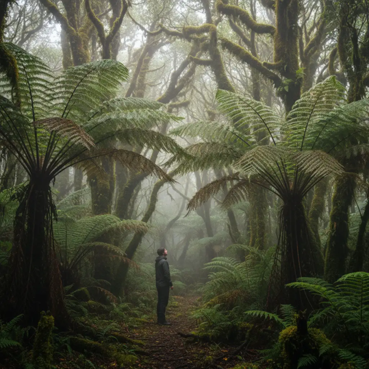
Photo courtesy sanctuary.org.nz
A “thank you” to Barry Wards for sending this article to The Upper Hutt Connection.
27/07/26
 The Upper Hutt Connection